Ask311: Search Vehicle Accidents and Illegal Dumpings Near You with AI
I built a tool that uses AI and maps to help you search for local vehicle accidents and illegal dumping data. Just enter an address and question—like “how many crashes near University & Purdue?”—and get answers pulled from real public records. Try it out!
I wanted to share a product I've been working on which allows the public to retrieve illegal dumping and vehicle accident data. Try it out at the link below:

Problem
Public data on illegal trash dumpings and vehicle accidents have historically been difficult to parse. For example, the East Palo Alto police department shares monthly Excel spreadsheets with the public works department on vehicle accidents, so that public works can use this data to make more informed roadway and intersection designs. When a residents submits a request for a stop sign, the engineering team will reference the Excel spreadsheets sheet by sheet, looking for how any vehicle accidents there were in the past 2 years and whether any of them were due to problems in roadway design - as opposed to driver errors such as DUI. As you can imagine, it is easy to miss data points when looking through data in this format because we want addresses in one area or one road segment, but the data has not been organized in that way.
Solution
I built a "geospatial-RAG" (retrieval-augmented generation) workflow which stores the geospatial data on illegal trash dumpings and vehicle accidents. The user can ask a question like they would to an AI LLM (large language model) and specify an address and radius. The workflow will then retrieve data points within that geospatial area and feed it into an LLM to answer the user-written question.
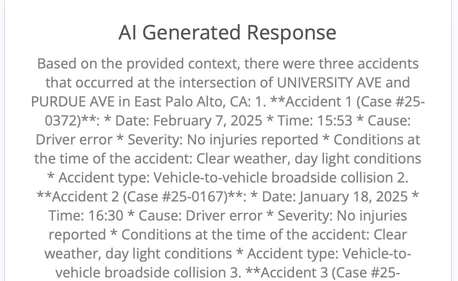
While I had originally built this with the City staff's use cases in mind, I realized that this data can be very useful for East Palo Alto residents too. For instance, I had a resident ask me how many accidents there have been at University & Purdue this year because they have heard 3 loud car accidents and they want to see a signalized traffic intersection added. I asked the system the question (Fig 1) and it correctly returned the 3 data points between Jan 2025 - Mar 2025 alone.
Examples
Vehicle Accidents
In Fig 1, there were 3 vehicle accidents at University & Purdue Ave in East Palo Alto in the Jan 2025 - Mar 2025 data that I have fed the AI system. The AI generated response summarizes details of these 3 accidents.
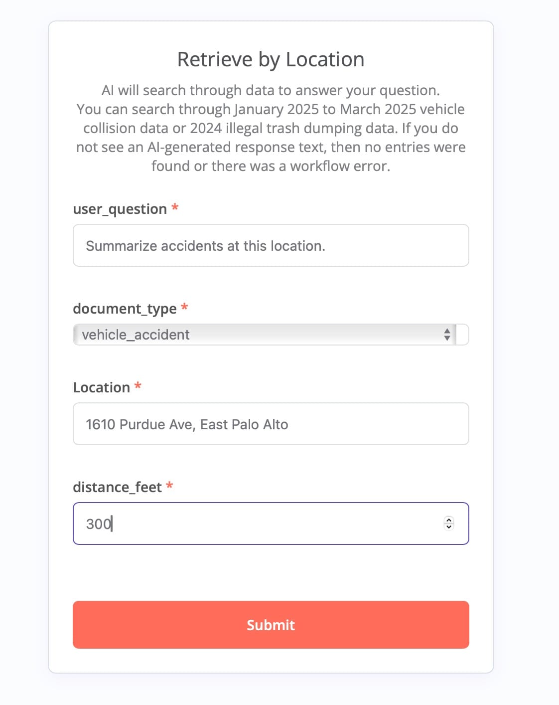
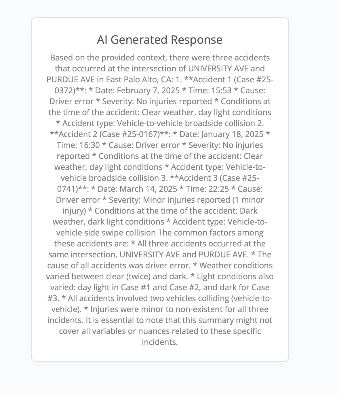
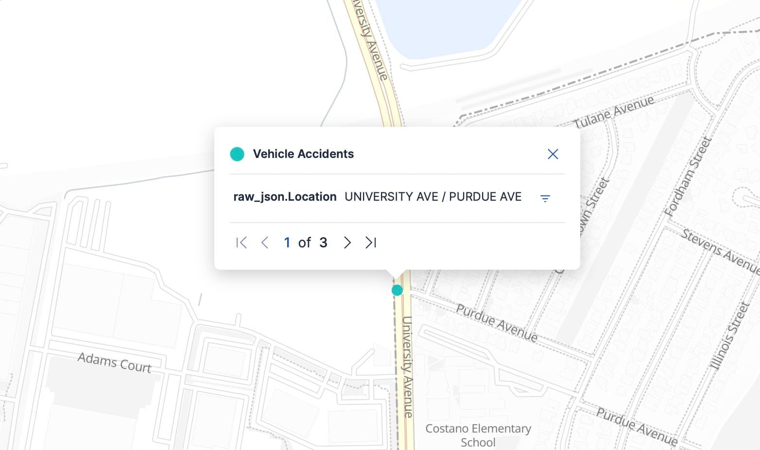
Fig 1. Vehicle accidents within a 300 foot radius of University & Purdue Avenue, East Palo Alto.
Illegal Dumpings
In Fig 2, I have asked for a categorization of illegal dumpings near 2411 Pulgas Ave (Ecumenical Hunger Program), which has had a lot of illegal dumping issues. Here, it was able to pull up this information from 2024 data.
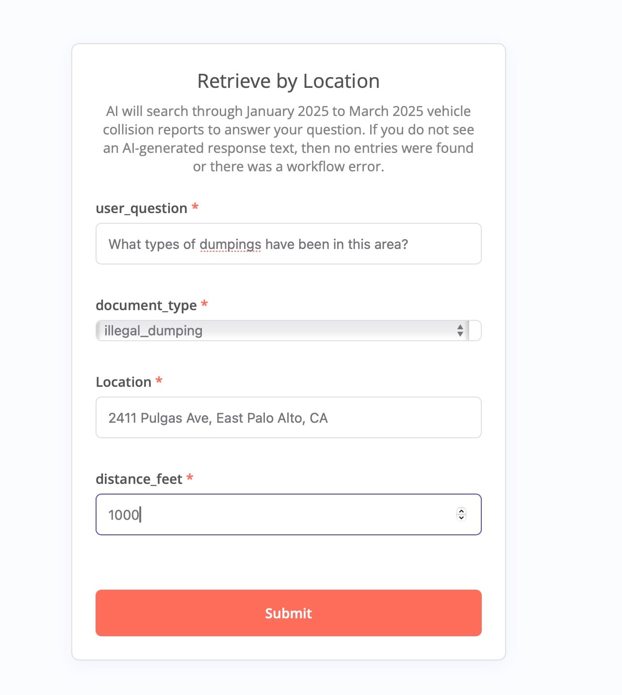
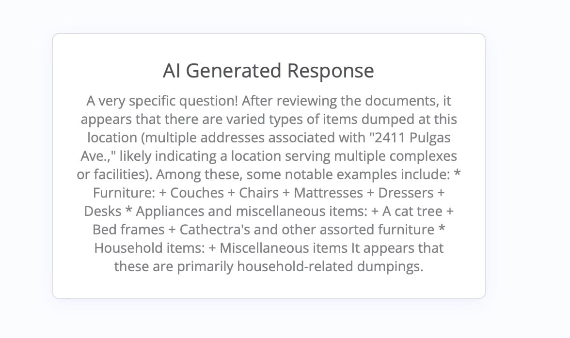
Fig 2. Illegal dumpings within a radius of Ecumenical Hunger Program.
Conclusion
I encourage you to try out the system. If you have suggestions or thoughts on other data you'd like to see, please comment below.