East Palo Alto Should Acquire 0.66 Acre Land for $100k for New Park
I think the City of East Palo Alto should acquire the ~0.66 acre land at the end of Verbena Dr for a new park. In this blog post, I aim to outline why I think residents would benefit from this and I outline a "design doc" for how the city can acquire the land for a new park.
A couple of years ago, I was walking with Mark on the west side of the San Francisquito Creek paved trail and when we were in front of this land we met a new neighbor who was walking his dog. He asked us, "Do you happen to know where I can find a dog park?" We both responded that we didn't know of one, and then we pointed to this land on our right and thought, "Why don't we put one here?"
I think the City of East Palo Alto should acquire the ~0.66 acre land at the end of Verbena Dr for a new park. In this blog post, I aim to outline why I think residents would benefit from this and I outline a "design doc" for how the city can acquire the land for a new park.
Why
East Palo Alto does not have enough parks. Per the East Palo Alto Parks Master Plan (PDF) approved on April 4, 2023:
Per the 2020 United States Census, the population of East Palo Alto was 30,034. This equates to 24 acres / 30,034 people * 1000 people = 0.80 acres per 1,000 people. We are 2.2 acres per 1,000 people behind our General Plan goal, which at a population of 30,034 implies that we need 30,034 people * (2.2 acres per 1,000) / 1000 = 66.08 more acres of park.
This number is assuming that we keep the population constant. Our population will continue to grow, which means that to reach the 3 acres per 1,000 people goal, we will actually need more like 80 to 90 acres of park, assuming a 40% or so increase in population in the future.
How can we reach this goal? An incremental approach is to acquire new land when we can find it. If it is not a good candidate for building more housing, then build a park.
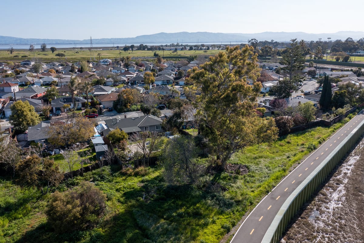
The Land

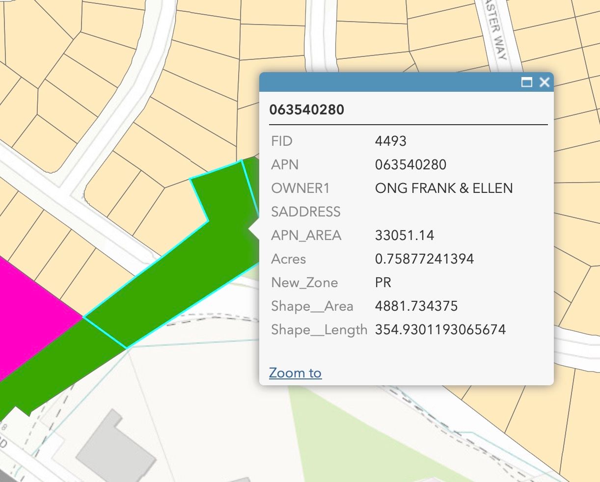
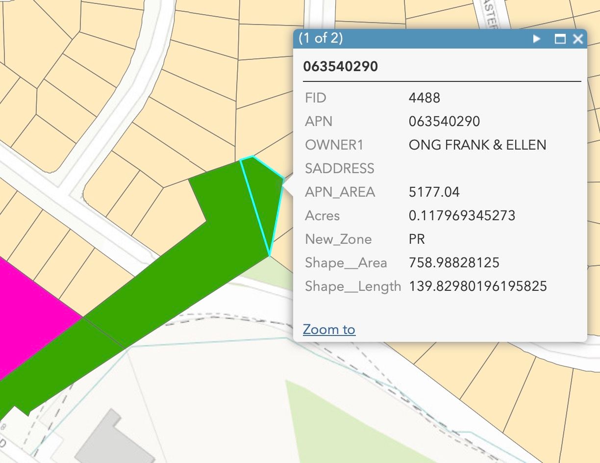
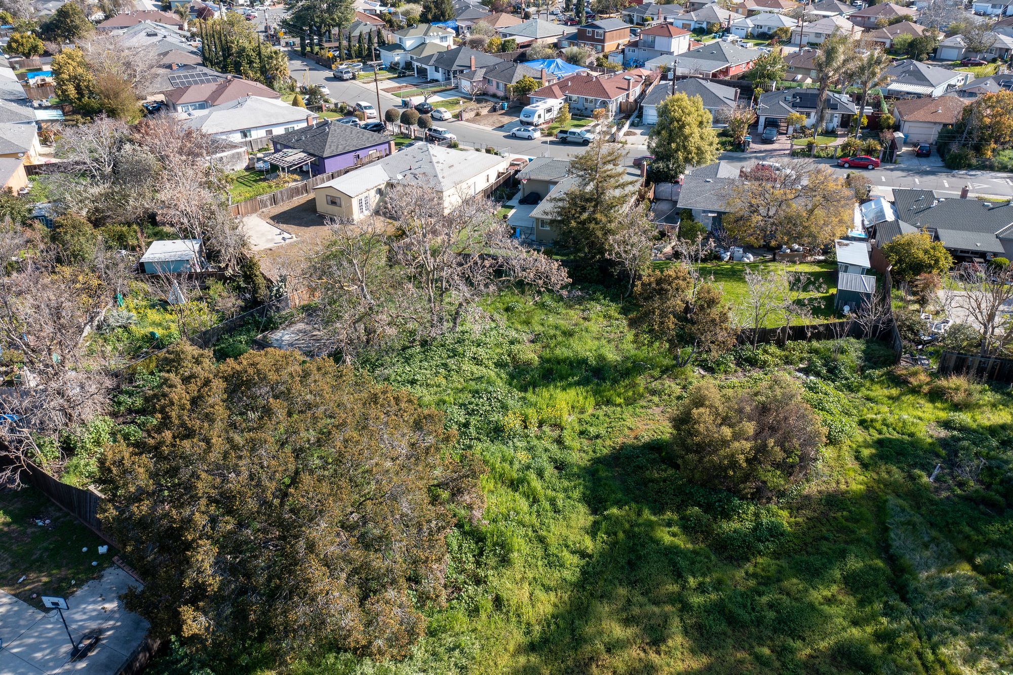
Parcels APN 063540280 and 063540290 are owned by an individual who is willing to sell the land combined for $100k to the city or a nonprofit entity which will develop a park. (The individual is not the owner listed in the screenshots below). The owner is not interested in selling the park to an individual or corporation for fear that they will turn around and get it zoned for 3 new houses or more housing.
Some neighbors and I have reached out to contacts in the city about the land for sale and so far we have not received interest.
Together, the lots are roughly 0.88 acres. However, because part of the land was utilized by the San Francisquito Creek Joint Powers Authority for building the Reach 1 - Downstream Project levee, I measure the buildable land for park to be roughly 0.66 acres.
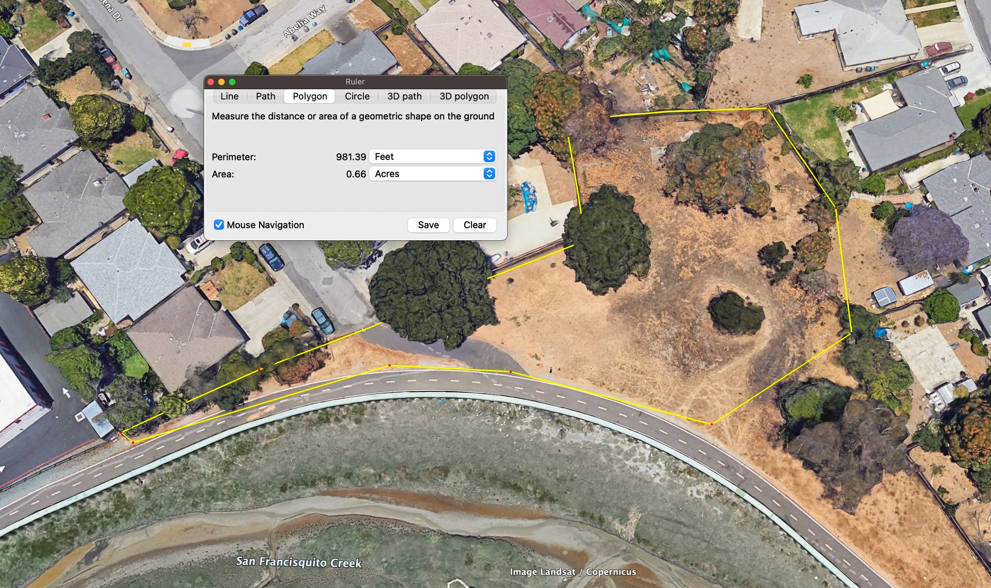
Note that the East Palo Alto Zoning ArcGIS does not note an owner for a triangle piece of land (in light green), which I measure to be approximately 0.25 acres.
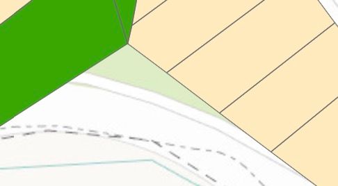
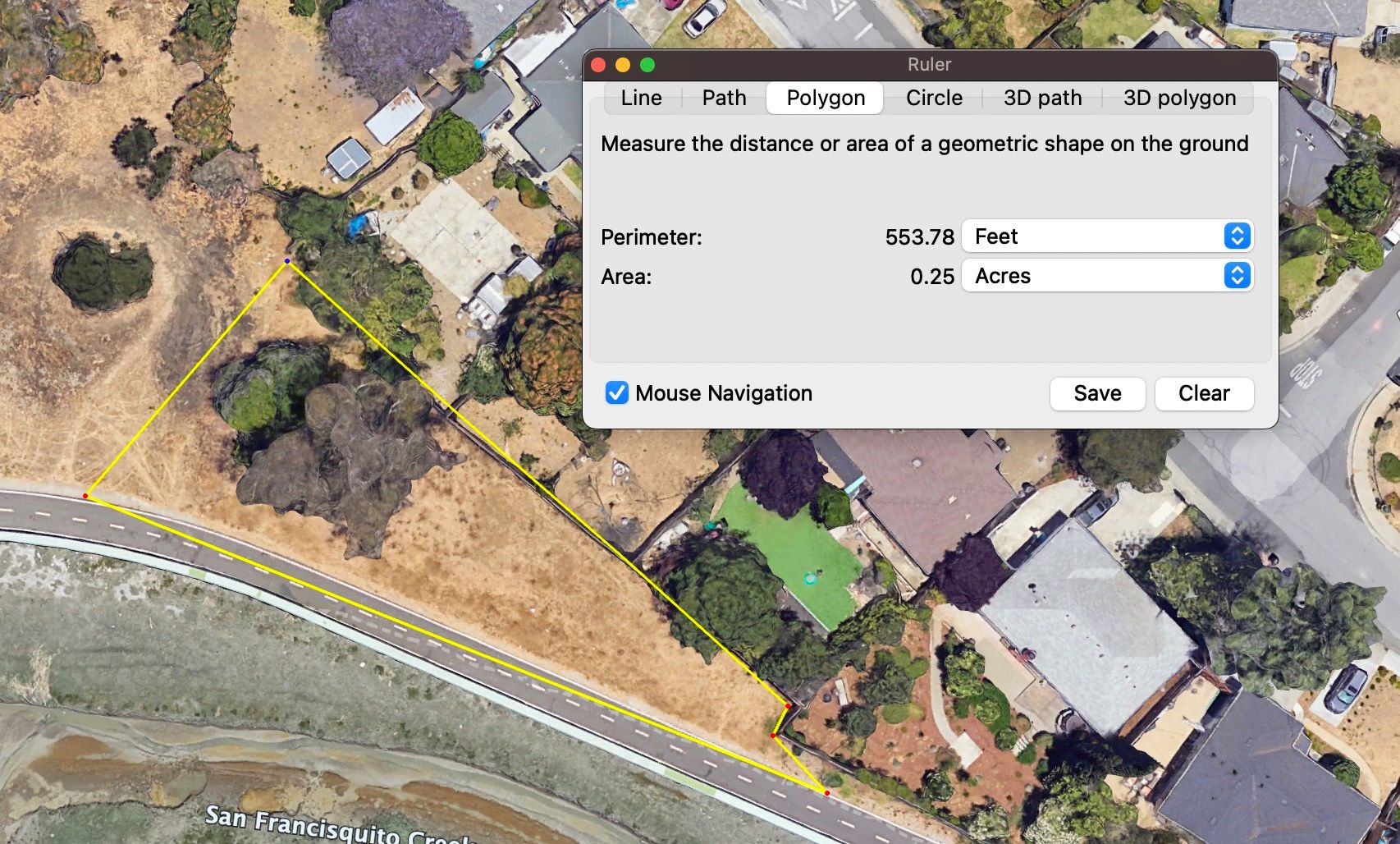
The owner does not own this ~0.25 acre lot. He thinks it is likely owned by San Mateo County, and if the city were to build a park here it would be wise to also acquire this 0.25 acre lot either from San Mateo County, the San Francisquito Creek Joint Powers Authority, or whichever entity owns it.
Location: Who will the park serve?
The land is located on the western bank of the San Francisquito Creek and its paved trail, about 300 feet to the north of the Highway 101. The park is accessible from the following locations:
- West: from the Gardens since the land is at the end of Verbena Dr
- North: from the paved trail on the western bank of the San Francisquito Creek, which has an entrance from the Gardens on Daphne Way and further north at O'Connor St
- South: from the ~300 foot segment on the south, which starts at East Bayshore Road
Of these directions, I believe that most visitors and the most value will come from the Gardens to the west (60% of visitors) and north (35% of visitors) because that is where people live. I would only estimate 5% of visitors coming from the south because the path dead ends at East Bayshore Road; there is not any housing in that vicinity; and it is not a popular route for cyclists, pedestrians, or runners.
Because the park is on the paved trail, I think the park would serve people who like to walk themselves (and their dogs) on the trail. Because the park is directly at one of the three only pedestrian outlets from the Gardens to the trail, I think that the park would serve a lot of residents of the Gardens.
Steps to Acquire the Land
The owner wants to see a proposal for how the land will be turned into a park. The city (or a nonprofit) should put together such a proposal, ideally with some conceptual design from a park design firm. The park might be a playground park for kids; it might be a dog park; it might be an open space preserve; etc. It would be nice to see a short 10 - 15 slide presentation with a plan for how the park will be structured.
Funding Sources
The city will need to allocate $100k in funds to acquire the park. Given that the city's General Fund Reserve exceeds $100M, I think that the city can purchase this land with an approval by City Council.
If the city prefers to pursue alternative funding sources, here are a few ideas:
- San Mateo County Parks Foundation, Enhancing Equitable Access Grant Program ($3,000 per grantee)
- If a developer does not build enough park land on their project site, perhaps allow the developer to develop this park in-lieu.
I am not very familiar with grants, so if you have ideas please comment in the Disqus comments below.
What to build
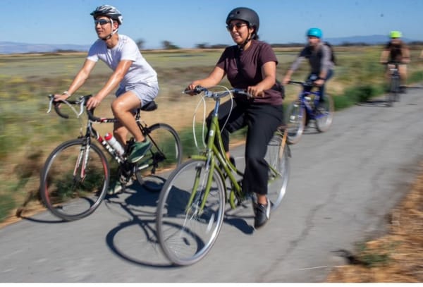
Given that currently most people walking past the land are typically walking on the trail (by themselves or with a partner) or walking their dog, I think that it would make a lot of sense to have some portion of this park be a dog park. I have noticed a lot of dog feces throughout the bay trail, anywhere from East Bayshore Rd up to Bay Rd and then further up to the Ravenswood Open Space Preserve. Having a dog park can help to reduce dog waste in the middle of the trail by providing a space for dogs.
While there are currently a number of pedestrians on this section of the trail, I have not noticed many cylists. I think this is mainly because the trail dead ends at East Bayshore just ~300 feet south, and East Bayshore which is the only option from there is not an enjoyable road to bike on (despite our city's nice effort of adding sharrows!), given its 35 mph speed limit, its lack of nature, noise pollution from the adjacent Highway 101, and lack of interesting places (unless you find a service station, self-storage, auto shop, more self-storage, and post office interesting). However, I believe that this may change in the future. Given the number of new pedestrian / bicycle overcrossings added to East Palo Alto and Palo Alto in the last few years, I think that the trend is moving towards more overcrossings. My prediction is that to further connect East Palo Alto east with west, a next overcrossing would make sense between the existing Clarke Ave and Oregon Ave overcrossings.
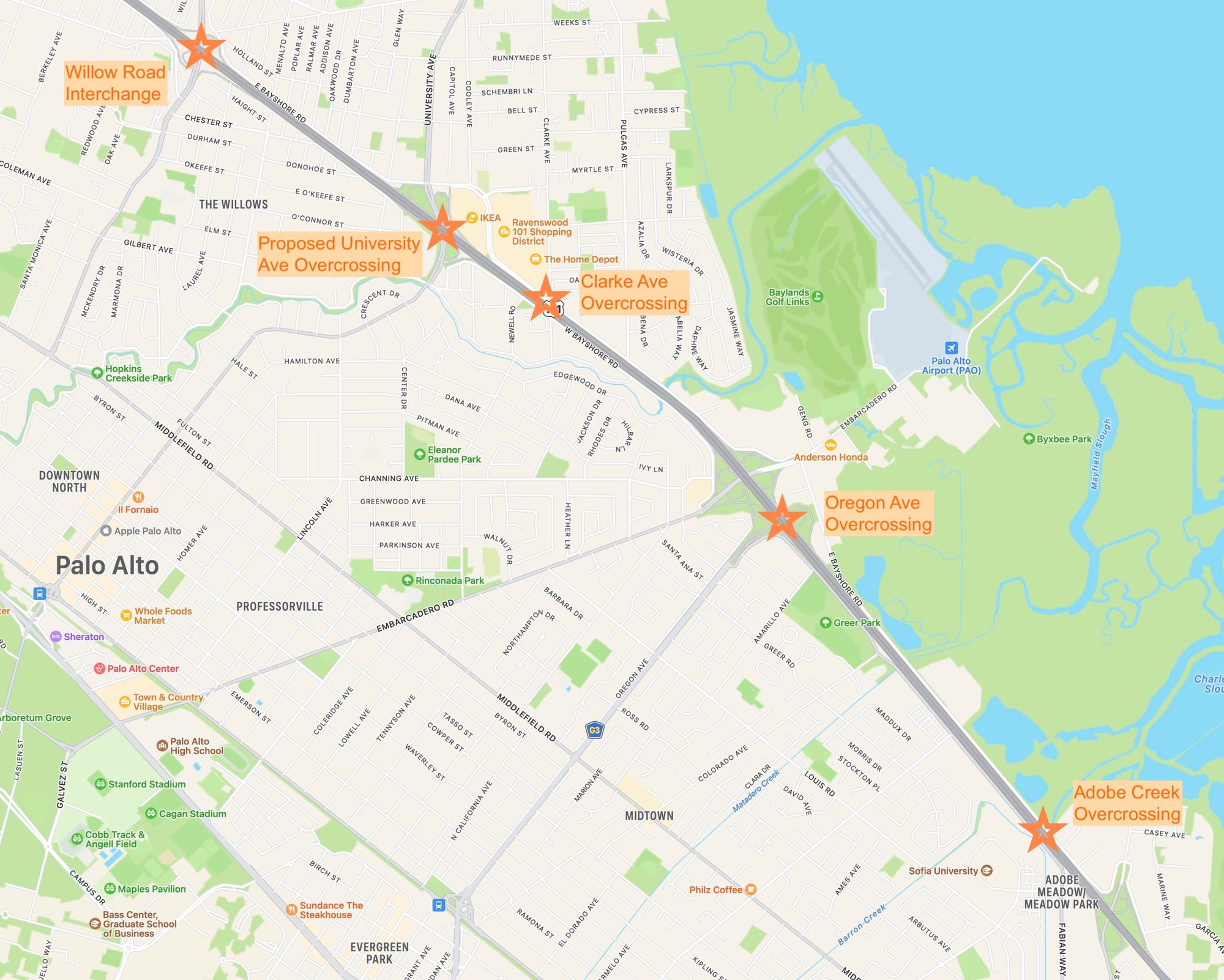
The distance between these two bridges is ~1.03 miles, and by adding an overcrossing between them (which is roughly the location of this park land), we can bring the gap down to 0.5 miles. This might look something like a bridge that starts from some land acquired from the self-storage unit on the east side of Highway 101 which traverses over Highway 101 and connects to a location in front of the Woodland Creek condominiums. If we had such a bridge, this would make this park land a great location for bike services and for the bike community which would now be able to access the San Francisco Bay Trail network from the Woodland Park community west of Highway 101 and from Palo Alto, without needing to ride on any roads on the east of Highway 101. It would also make the any new development on either side adjacent to the freeway more connected to public parks.
I do not think the park should be catered entirely to bikes right now, but it is something to keep in mind and we could still include something like a bike service station to serve the cyclists coming from the Gardens via Verbena Dr.
Next Steps
If you have any ideas, please reach out or leave a comment below. We would love to make this happen and if you can share this document with others to get the ball rolling that would be awesome!