We created this map visualization of parking citations in East Palo Alto. The data was obtained by a Public Records Act request from the East Palo Alto Police Department for July 2024 to June 2025.
Filtering
See the Vehicle Collision Data page for tips on filtering.
Vehicle Collisions Data
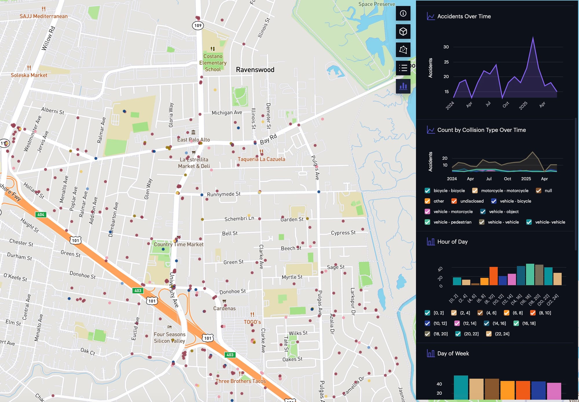
We created this map visualization of vehicle collisions in East Palo Alto. So far, we have obtained data from the East Palo Alto Police Department for January 1, 2024 through June 30, 2025 (18 months). Here is the link: https://studio.foursquare.com/map/public/af47803e-4489-414f-8bd3-d4444c486685 Feel free to make
Methodology
We obtained a PDF which included a list of addresses. We extracted the text from the PDF into a data format, and then used the Google Maps API to geocode the addresses into latitude and longitude.
We then applied a random offset to the latitude and longitude so that points would not cover each other in the Foursquare Studio visualization.