How Reporting a Google Maps Error Reduced Cut-Through Traffic in East Palo Alto
Some East Palo Alto streets face heavy cut-through traffic as navigation apps route drivers through illegal turns. By submitting corrections to Google and Apple Maps, I helped redirect traffic to main roads, aligning with city planning efforts to reduce congestion in residential areas.
Context
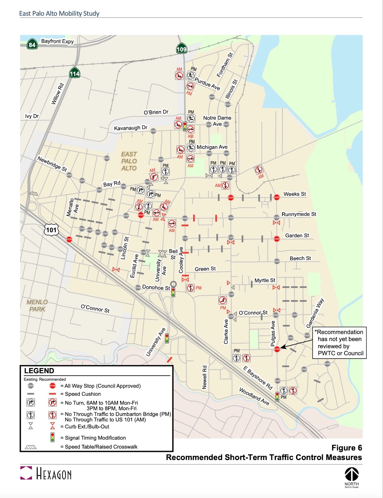
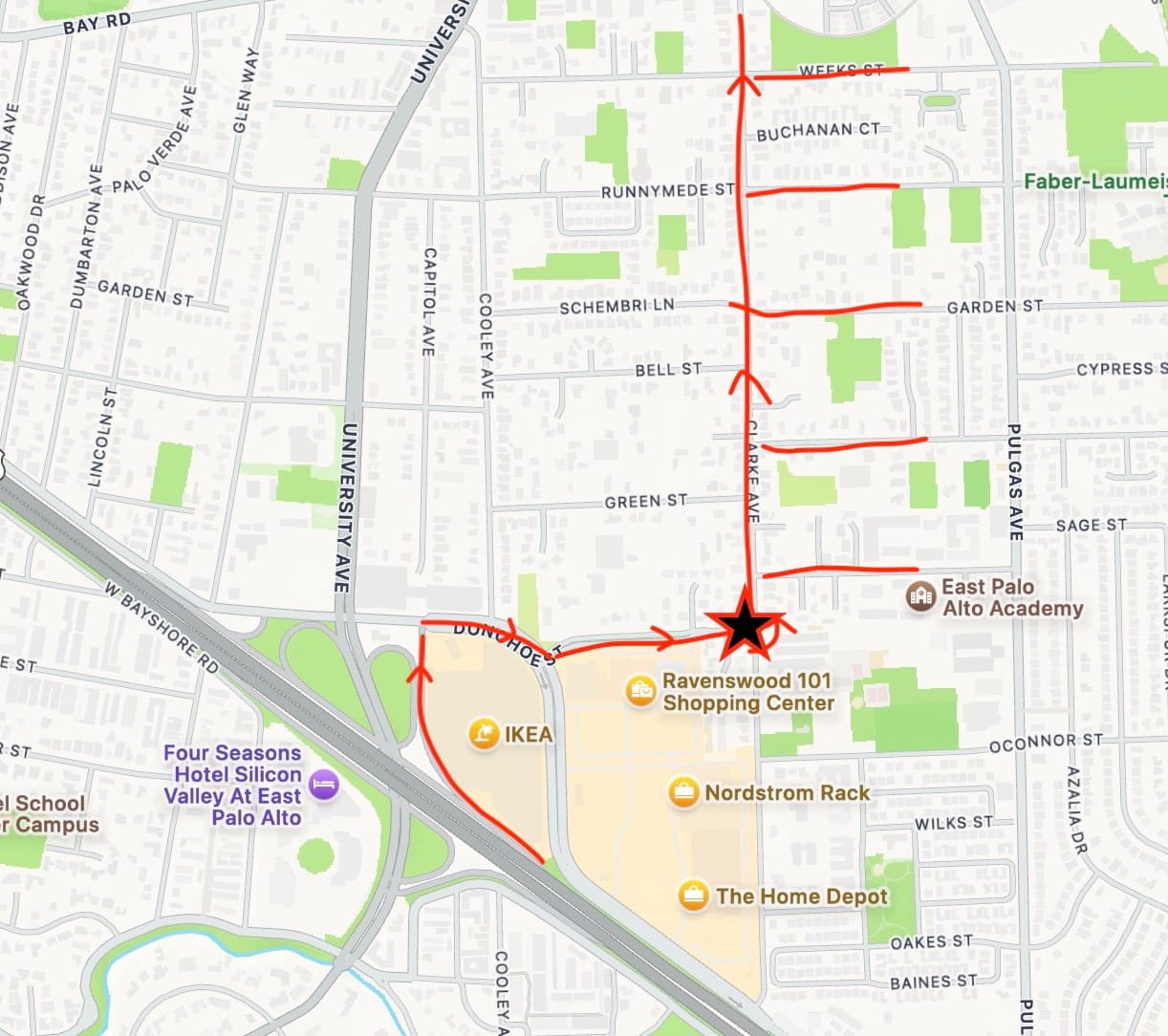
East Palo Alto residents experience a lot of cut through traffic on weekdays during morning and evening rush hours, mainly from Dumbarton Bridge drivers who detour into residential streets in order to avoid congested main roads. Our previous City Councils heard these complaints from residents and approved the recommendations from the Mobility Study 2020, which “covers a broad range of topics including a discussion of existing cut-through traffic patterns and strategies for reducing cut-through traffic” (page 1). The City implemented 11 no turn signs on weekdays (Fig 1): 5 restrictions from 6 AM to 10 AM and 6 restrictions from 3 PM to 8 PM.
Problem
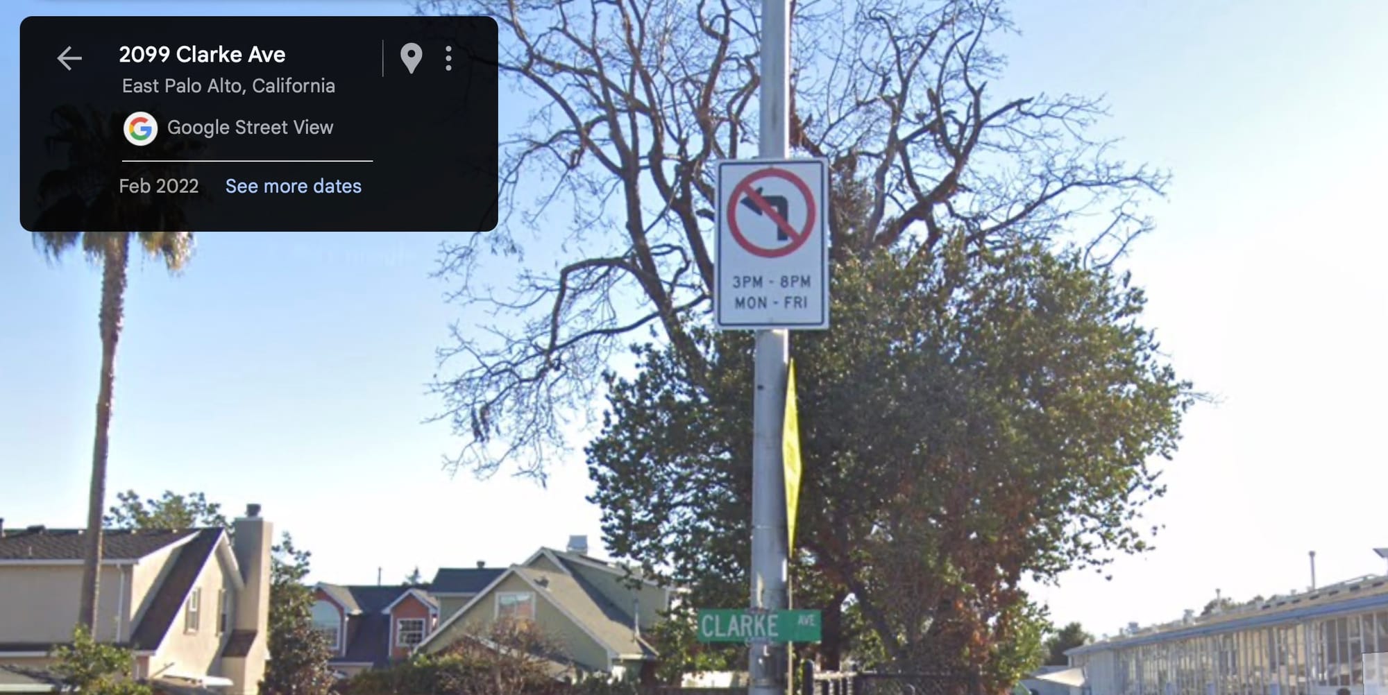
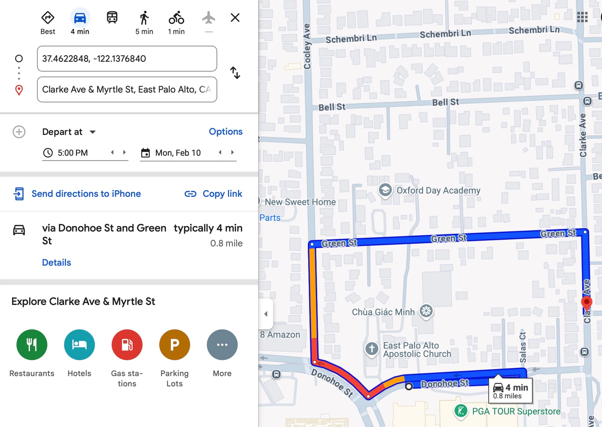
Even though signage has been posted that drivers cannot turn left at certain intersections, yet many continue to make illegal left turns. I personally experienced this when my app-based navigation system (Apple Maps) navigated me through one restricted left turn area from Donohoe St EB to Clarke Ave NB during PM rush hour. When I researched this more, I realized that Google Maps also had the same incorrect routing (Fig 2).

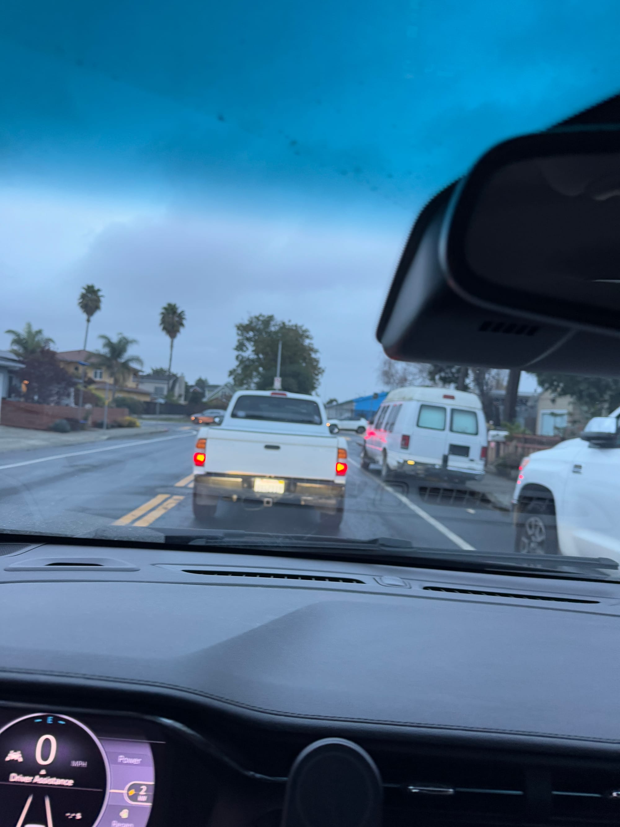
In Fig 4, there was a line of approximately 8 to 10 cars on Donohoe St, all waiting to make an illegal left turn onto Clarke Ave. Every car before and after me the illegal left turn. I don't know how many drivers were using GPS-based navigations, but I could imagine that Dumbarton Bridge commuters who are even less familiar with East Palo Alto streets would feel like they have no choice but to make the illegal left turn if their GPS routing brought them to Donohoe St & Clarke Ave and then they learned that left turns are illegal.
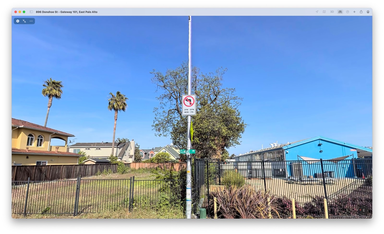
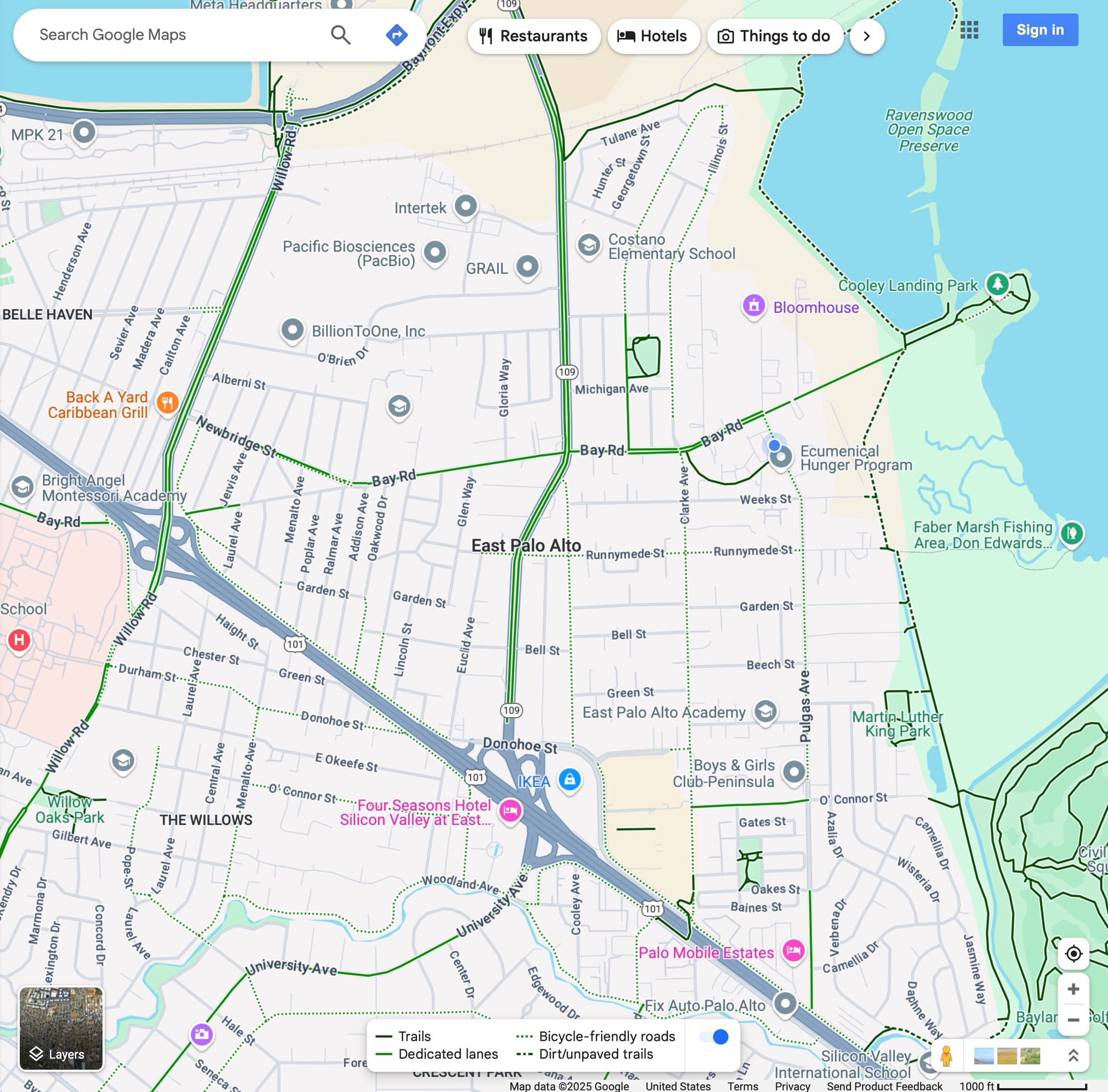
The impact of this problem is that more Dumbarton Bridge drivers cut through on Clarke Ave, which congests the road for East Palo Alto residents who might be using Clarke Ave to get home or to go on Clarke Ave to pick up their kids at schools on Clarke Ave. Also, given that the Donohoe St & Clarke Ave intersection acts as a gateway (Fig 5) into East Palo Alto residential streets, drivers who illegally turn left onto Clarke Ave might turn onto other residential roads further to the east to avoid traffic, which would further congest residential streets in East Palo Alto. Or, they could more easily (compared to drivers on University Ave or Cooley Ave) continue straight onto Illinois St past Bay Road and then cut through the University Village neighborhood, which also has no turn signs.
Quantification of Problem
Of the 11 "No Turn" signs implemented based on the Mobility Study's recommendations, 3 of them were not respected by Google Maps routing as of 1/4/25:
| Location | Respected in Google Maps on 1/4/25? | Submitted to Maps Content Partners |
|---|---|---|
| University Ave left turn to Michigan AM | No. Routing | Submitted on 1/22/25, approved 2/5/25. |
| Glen Way NB right turn to Bay Rd PM | No. Routing | Submitted on 1/19/25, under review. |
| Donohoe St left turn to Clarke Ave PM | No. Routing | Submitted on 1/19/25, approved on 2/8/25. |
Solution
I worked with our City's Public Works department to submit the no turn restrictions to Google's Maps Content Partners; it is a portal which I also wrote about in this other blog post for cities to submit geospatial data to Google Maps.
Donohoe St & Clarke Ave
Fig 6 shows how I submitted the map edit in Maps Content Partners for the Donohoe & Clarke intersection. Because the turn restriction is for the Donohoe St segment, that is why I selected that in the 3rd image in Fig 6.
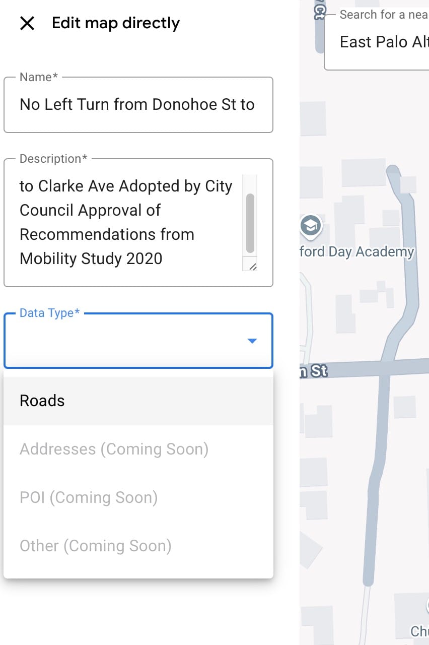
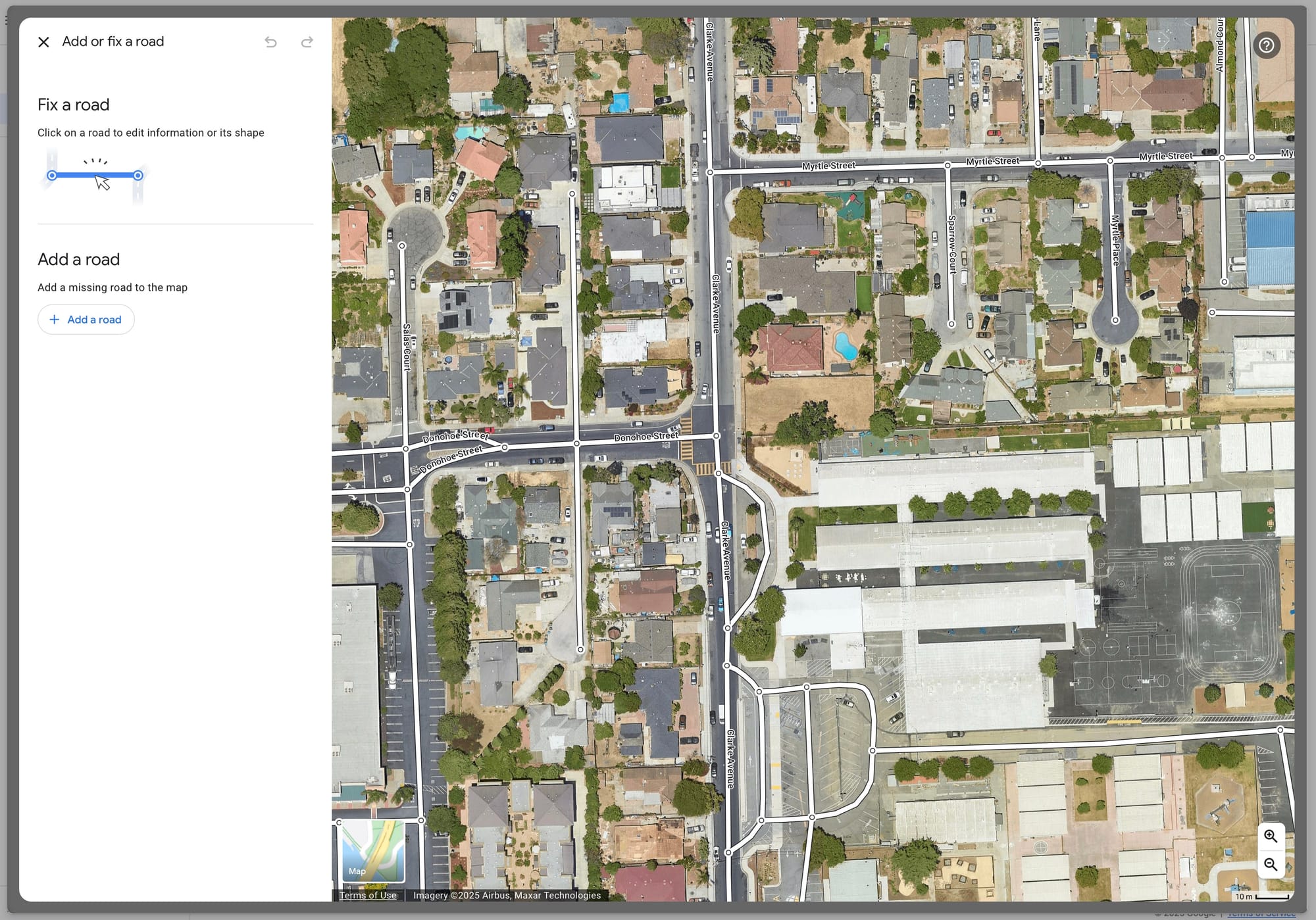
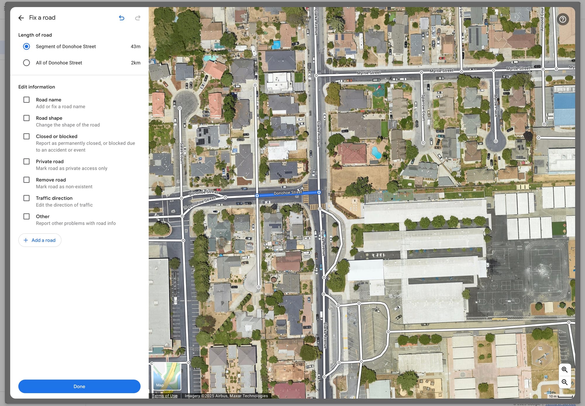
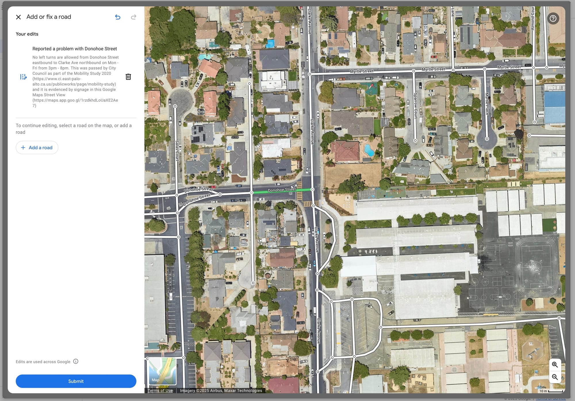
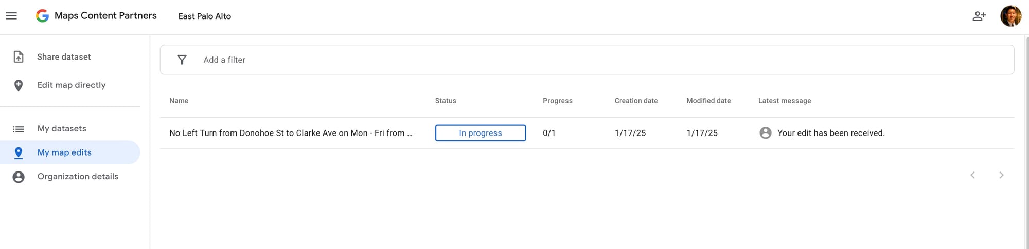
Fig 6. On January 17, 2025, I submitted the no turn restriction to Google Maps Content Partners with a link to Google Street View imagery showing the posted no left turn sign from Mon - Fri 3pm to 8pm.
Luckily, this was accepted relatively quickly on 1/28/25, and this Google Maps routing in Fig 7 provides evidence that drivers cannot make a left from Donohoe St to Clarke Ave. In reality, Google Maps would likely never take a driver in this odd path. Instead, Google Maps would route drivers to University Ave or Cooley Ave instead of cutting further through East Palo Alto's residential streets. When congestion on University Ave gets really bad, instead of routing drivers to residential streets like Clarke Ave, Google Maps would send drivers to Willow Rd (California State Route 114) which is the correct connector between Highway 101 and Highway 84.
I also submitted this turn restriction to Apple Maps on 1/23/25 (Fig 8), and it was approved on 2/8/25 (Fig 9).

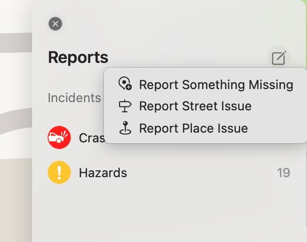
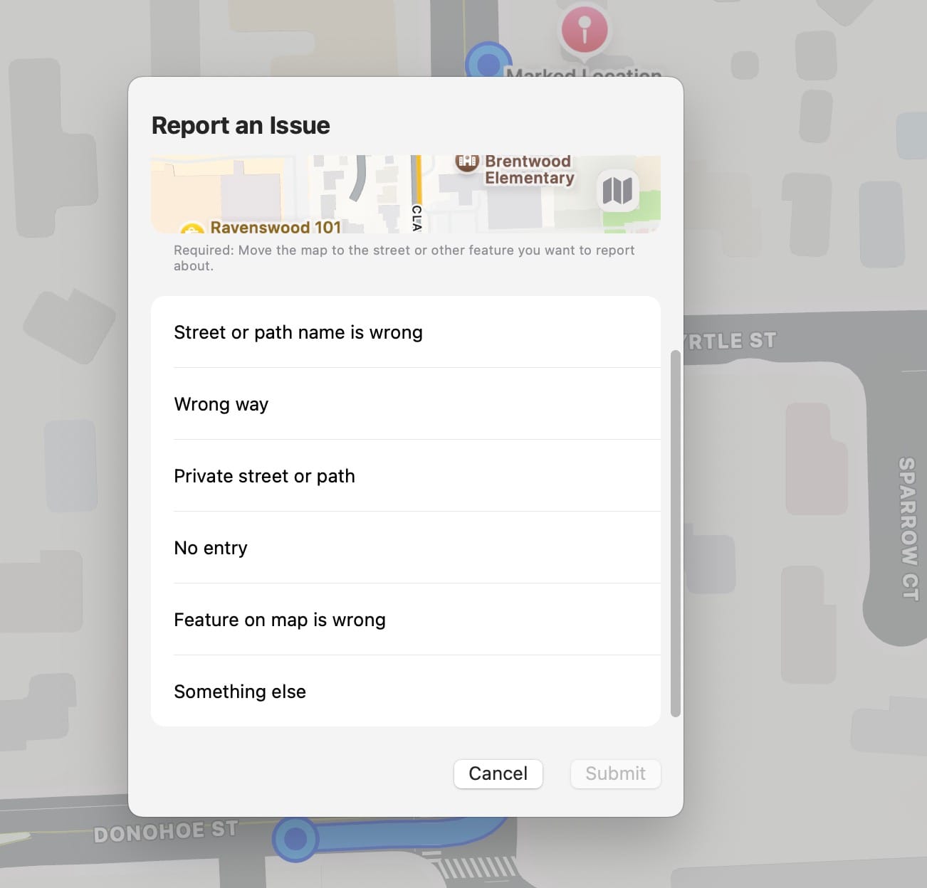
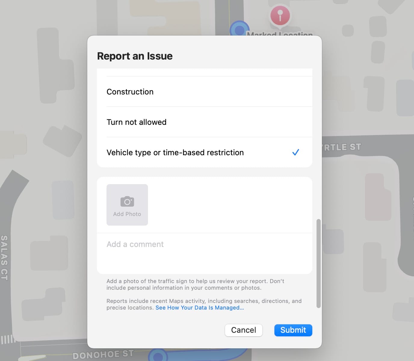
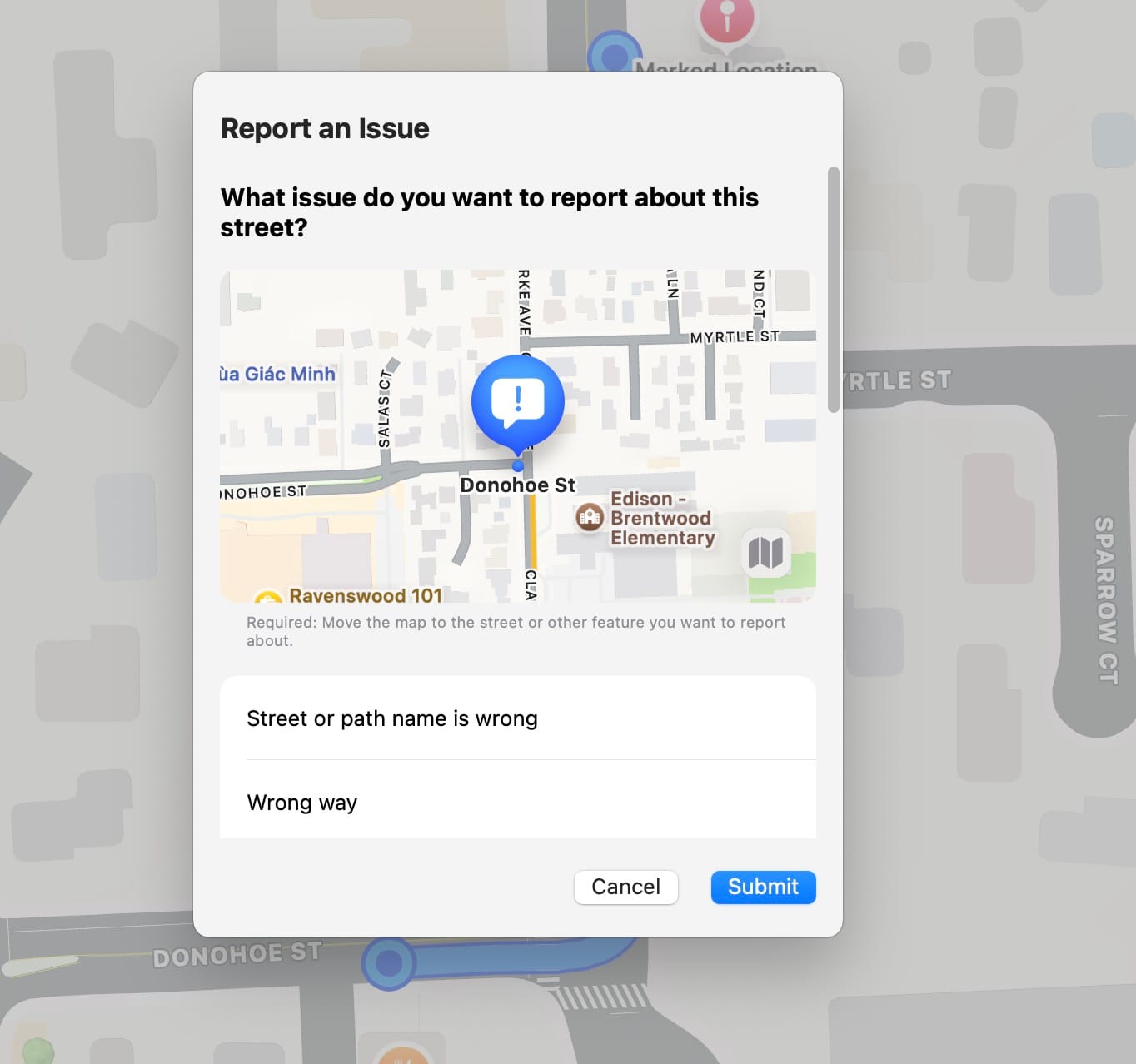
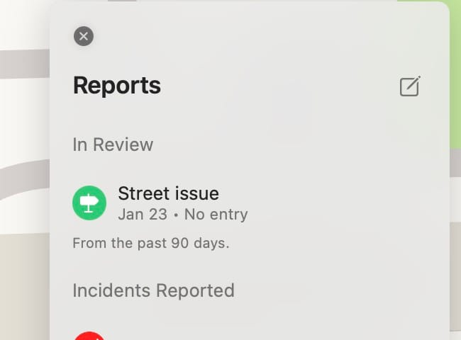
Fig 8. On January 23, 2025, I submitted the no turn restriction on Donohoe St & Clarke Ave to Apple Maps through the Maps Mac app.
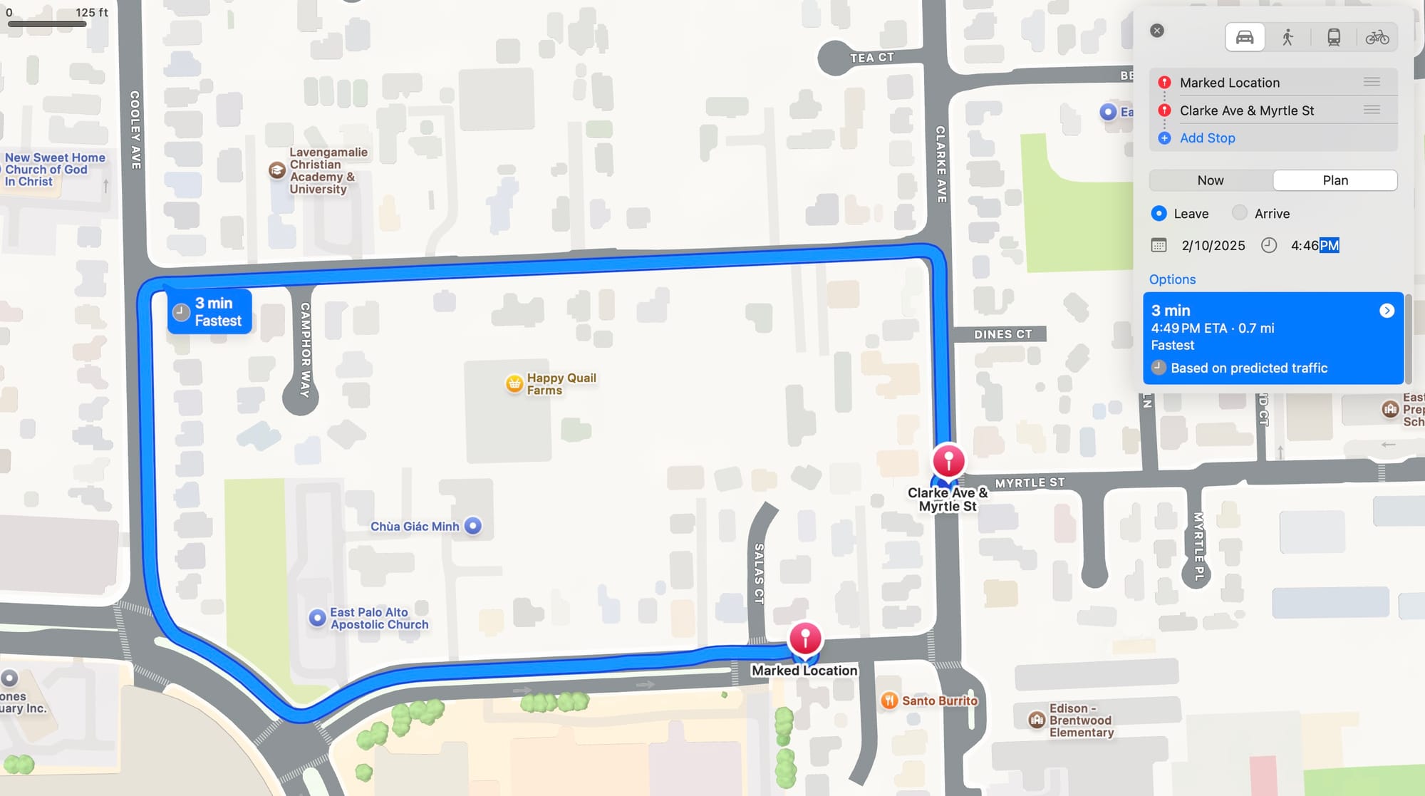
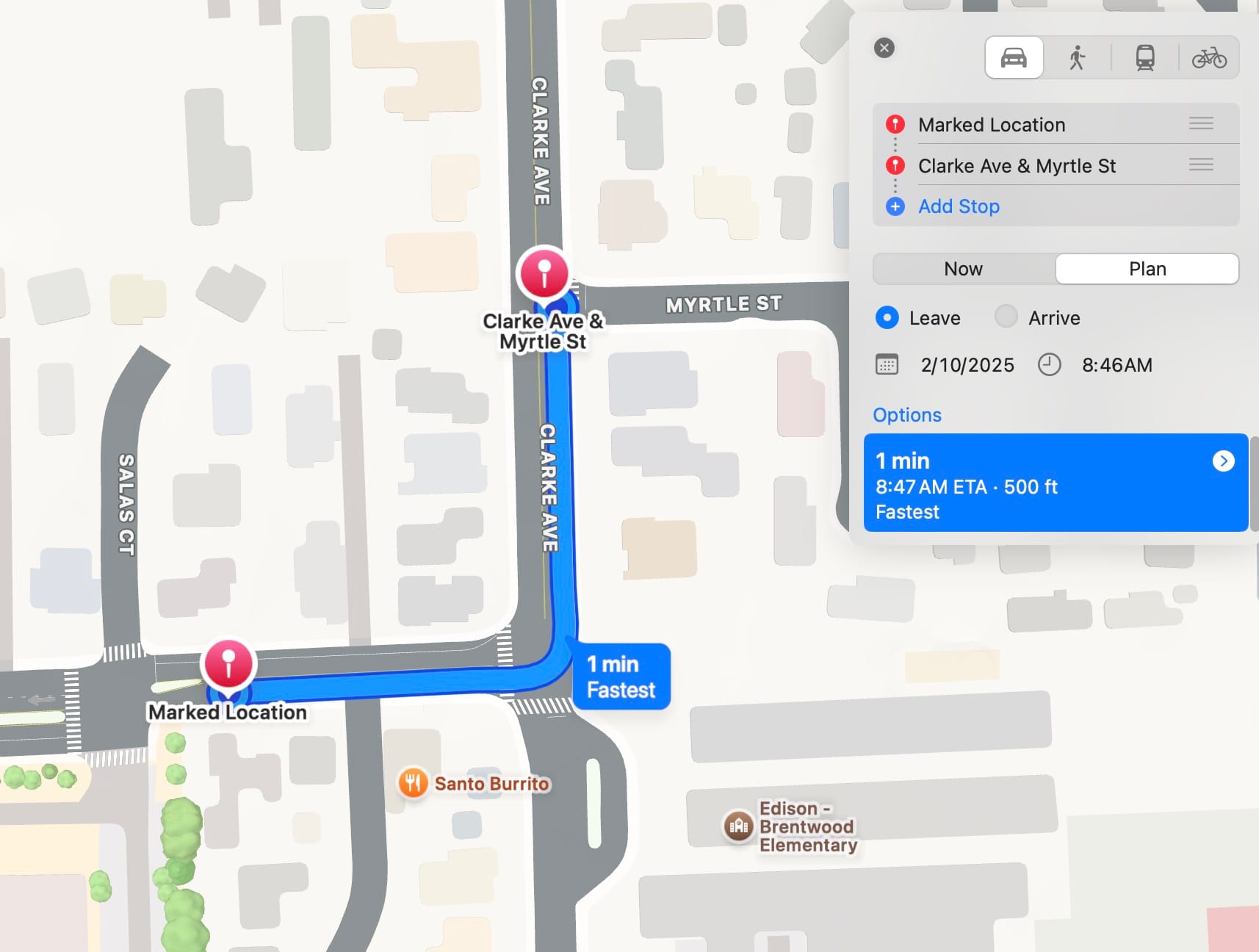
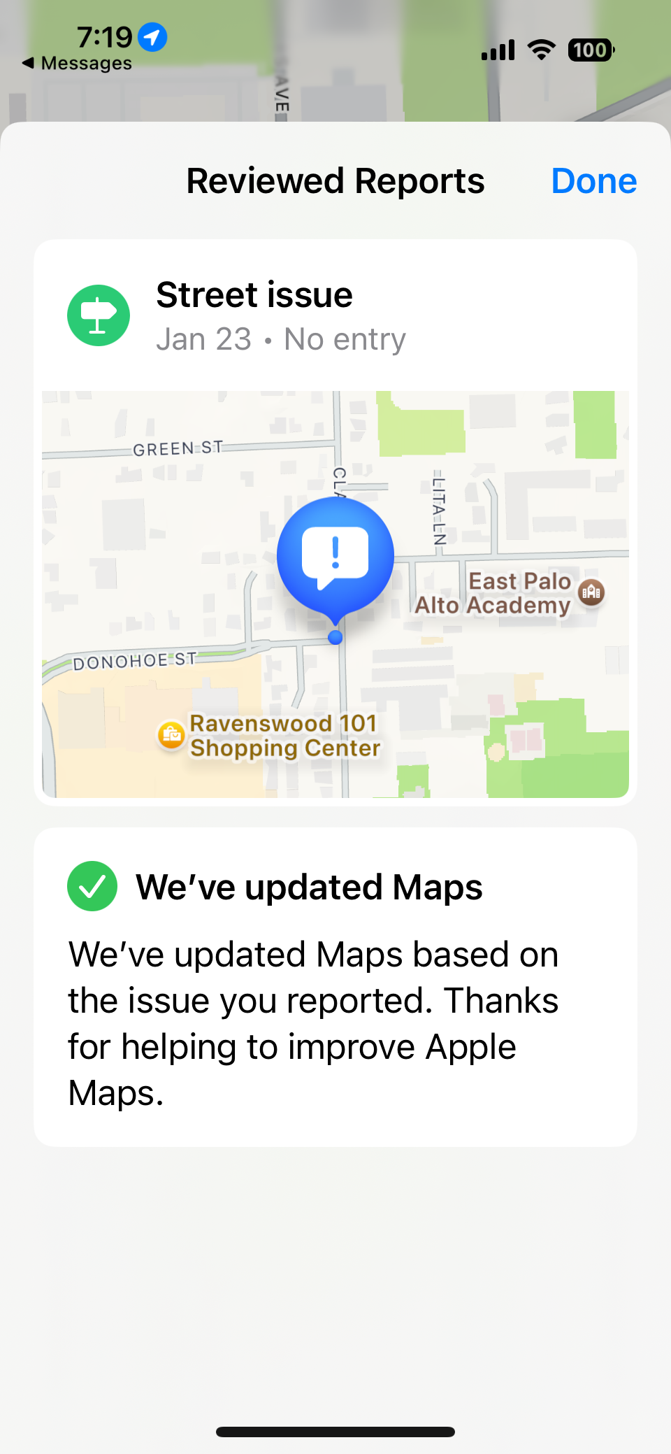
Fig 9. On 2/8/25, Apple Maps notified me that my reporting was approved. The first screenshot shows that during weekday PM rush hour, Maps does not route the left turn. The second screenshot shows that outside of the PM rush hour, the left turn is routed. This aligns with City Council's approved turn restriction.
University Ave & Michigan Ave
I repeated the same steps as above to submit the turn restriction at University Ave & Michigan Ave. The impact here is that AM Dumbarton Bridge drivers will not be routed to turn left off of University Ave onto residential streets in the University Village neighborhood.
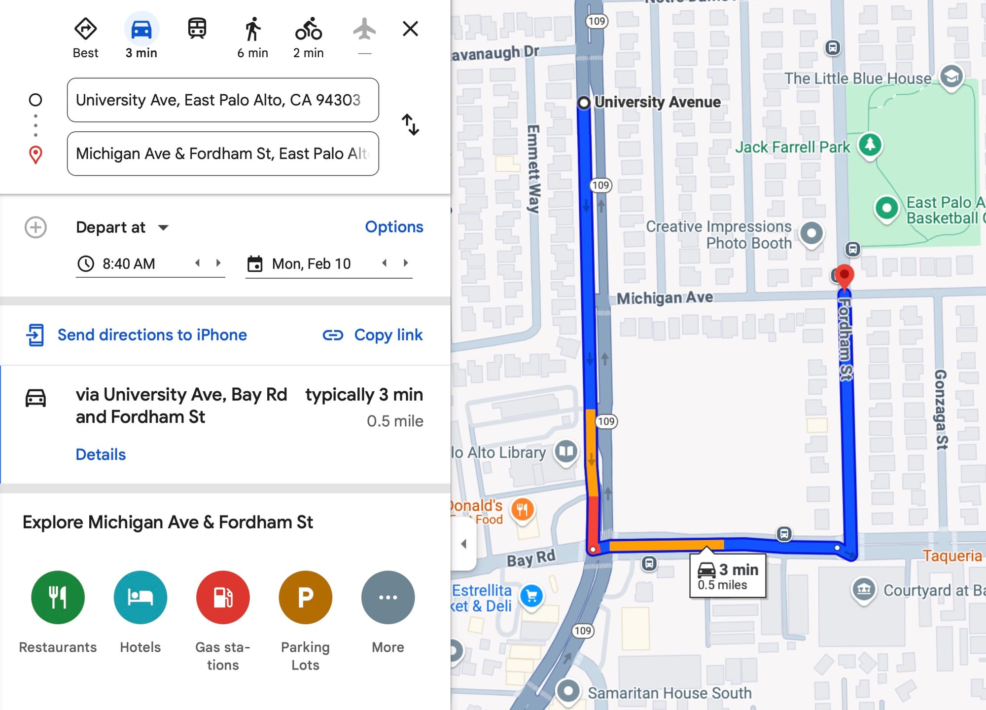
I have yet to submit these to Apple Maps, and I will plan to do those soon.
Bay Rd & Glen Way
This no turn is still under review by Google Maps. I have yet to submit this to Apple Maps.
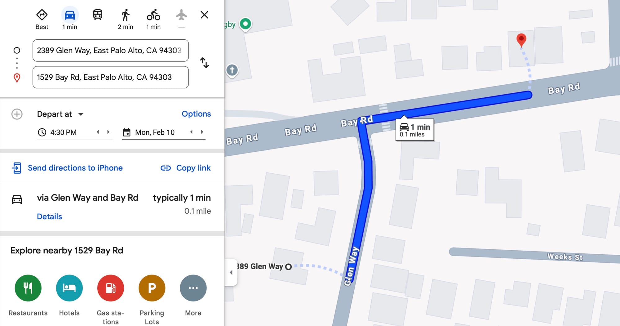
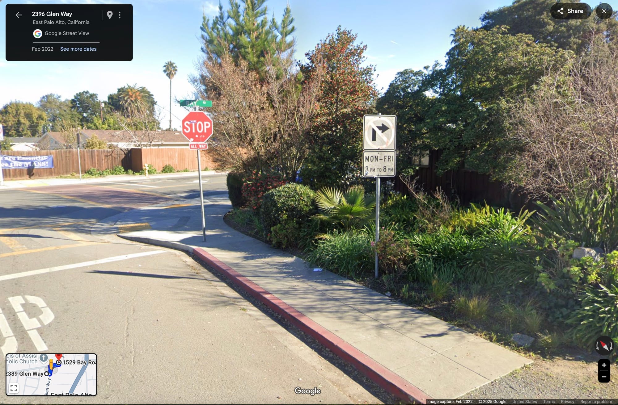
Fig 11. Google Maps routes an illegal right turn during PM rush hour from Glen Way NB to Bay Rd EB. Link to second Street View image.
Preventing This Problem in the Future
Enforcement
It is generally agreed that enforcement is key to changing human behavior, and I do not think we have enough enforcement of these turn restrictions. At the same time, I realize that this type of issue would be at the bottom of the police department's priorities, so I think it would be great if we could automate enforcement of the turn restrictions in some way. I hope to discuss with our police department further to see if it is feasible and legal to automate this. An automated device can also provide the City with data to assess whether the map routing changes and the Mobility Study's recommendations have effectively reduced cut-through traffic.
Automated Updating of Maps
I think that Google Maps already makes a best effort to automatically add no-turn restrictions by processing its Street View imagery. This is evidenced by the fact that 8 out of 11 no turn restrictions were already being followed by their routing. In this case, 3 out of 11 turn restrictions did not get updated, and it took me 4 years of driving before I realized firsthand that this was a problem with Google Maps and Apple Maps routing. Imagine if there was a company that could automate this entire process. Because this is such a manual process with a lengthy review period, this problem is also likely one of the lowest priorities for our City's public works department.
How to Submit Incorrect GPS Navigations
If you see incorrect routing on Google Maps, you can submit this directly from your personal Google account. For instance, for the Glen Way & Bay Road restricted right turn I submitted with these steps in Fig 12 just now on 2/10/25. Let's see if the submission from my personal account gets reviewed faster than the submission I made from the Maps Content Partners account which has been under review since 1/19/25.
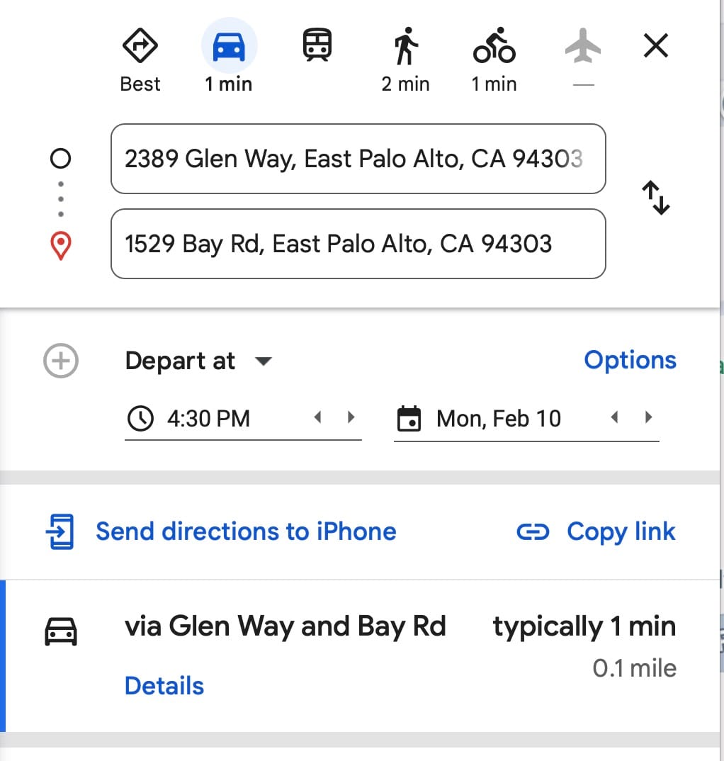
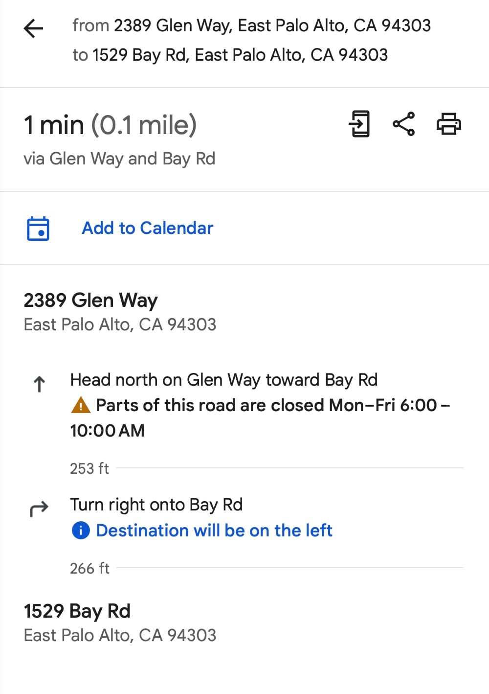
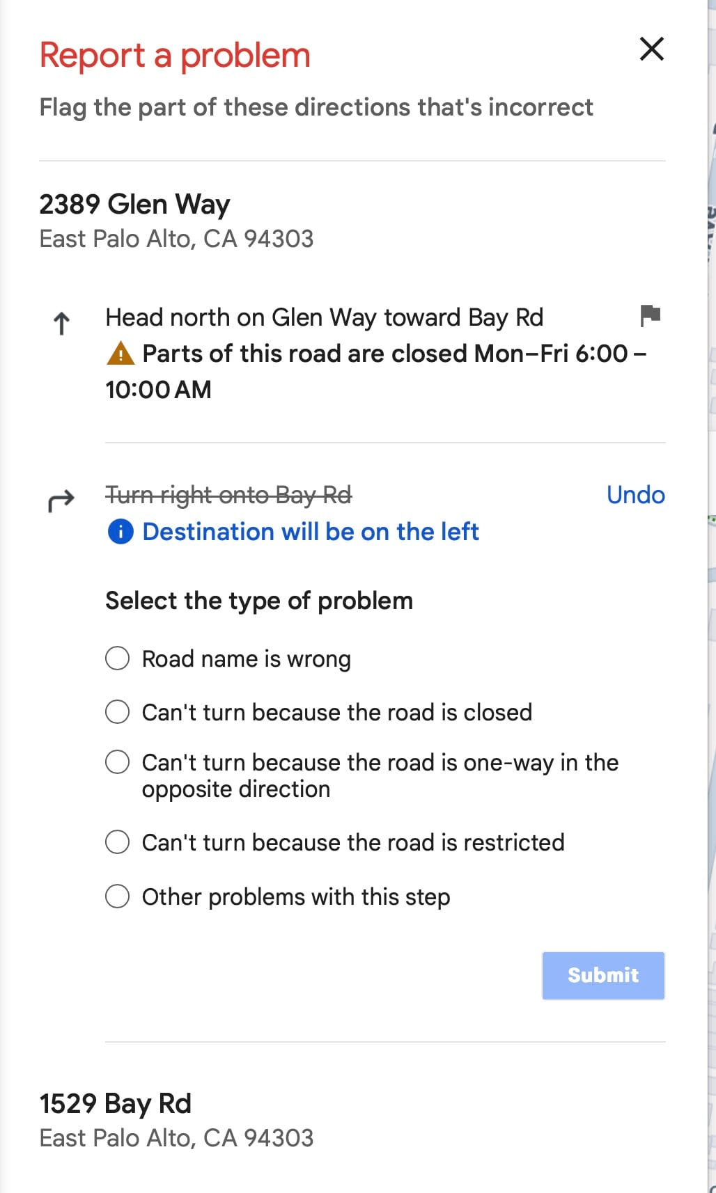
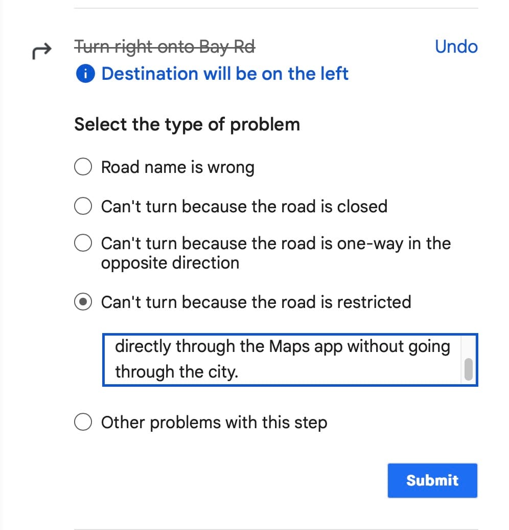
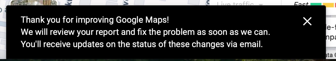
Fig 12. In the third screenshot, I clicked on "Send Product Feedback" and then in the fourth screenshot I flagged the incorrect right turn with the problem "Can't turn because the road is restricted." I then submitted the details: "Right turns are not allowed on Mon - Fri from 3pm - 8pm per City Council code and approved posted signage: https://maps.app.goo.gl/THHD5nN95m2k6rhb9."
For Apple Maps, you can report the issue directly through the Maps app.
If after a long time Google Maps does not approve your request, please send an email to engineering@cityofepa.org with screenshots and a link to the incorrect routing. The City has access to Maps Content Partners to make the submission request.
Conclusion
I would like to hear your thoughts in the comments section below. A small digital change like this has the potential to make big positive cut through traffic reductions for East Palo Alto residents. It tweaks the algorithm to route traffic towards the main arteries like University Ave and Willow Rd. When traffic becomes bad enough on those main arteries, some Dumbarton Bridge drivers may change their behavior by driving outside of rush hour; taking transit on the Dumbarton Express, AC transit, or Stanford's Marguerite shuttles; carpooling; or moving closer to their job.
East Palo Alto's residential streets have served as a bandaid solution to the real bigger problems for too long. Traffic comes from cars. Cars come from car trips. Car trips come from a need to drive somewhere to get home or do something. The need to drive to get home comes from the home being farther away from work, or vice versa. The need to drive to do something comes from the something to do being farther than you would like. Even if East Palo Alto does nothing, regional traffic congestion is projected to increase (Ravenswood Business District specific plan update). So let's do something and bring housing closer to jobs. Let's leverage increased density to support transit and decreased numbers of car trips. Longer term solutions like this are going to improve the quality of life for current and future East Palo Alto residents. The maps routing fixes I wrote about in this blog post are also a bandaid solution. It will help for the short term, but we as a City need to continue planning for the future.